
A Geological Ski Tour of Mt. Shasta
Share this Post
The young summit looked like a volcanic rock fortress, a specter surveilling the crater below, covered in rime but otherwise untouched by time. According to the map, it was only 600 ft. or so above where we stood, but it appeared a thousand times taller before us.
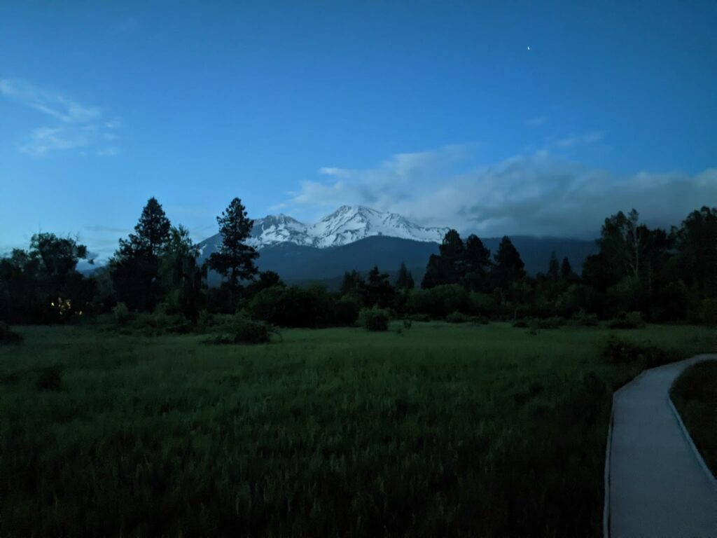
Just before midnight, Nathan and I began the drive up the long, curving road from the town of Mt. Shasta, California to the Bunny Flat trailhead at the base of Mt. Shasta, some 40 miles or so south of the California-Oregon border. We spent the better part of the previous hour watching the 14,163-foot tall mountain in the starlight at Sisson Meadow park before beginning our automobile approach. We drove in separate cars, but I could feel our joint anticipation mounting as we neared the base of the giant.
A Volcanic History
As far as recent volcanic history goes, in the last 10,000 years, Shasta has erupted at a rate of once every 600-800 years, making it the second most active Cascade volcano, behind Mt. St. Helens. As a student of geoscience from the Intermountain West, I was wide-eyed at my recent personal discovery of real-life volcanoes here in the Western U.S. I wanted to get close to them. I have since taken to reading about the Cascade volcanoes in Stephen Harris’s “Fire and Ice” and “Fire Mountains of the West”, two books whose depth of geologic insight informed my understanding of Shasta as presented here.
The Cascade volcanoes are arranged in a roughly north-south arc from northern California up to British Columbia in Canada. These volcanoes formed as a result of hot earth material upwelling from the diving down of the Pacific tectonic plate underneath the Pacific coast of North America. Of the 20 or so major Cascade volcanoes, Mt. Shasta is second in height only to the giant Tahoma (Mt. Rainier, 14,411 ft.) to the north in Washington State. It is, however, the largest stratovolcano (cone volcano with steep sides, the kind you’d probably envision if asked to draw a volcano) in the Cascades by volume, composed of 85-90 cubic miles of lava material. The mountain is exceptionally prominent, visible for many miles surrounding it. It drew us in from great distances without its massive stature seeming to change at all.
The Science of Stratovolcanoes
Stratovolcanoes form tall, steep structures due to the high viscosity of the lava material. In general, lavas with more silica are more viscous and are lighter in color when cooled, like andesite or rhyolite; Lavas with less silica are less viscous and are darker in color when cooled, like basalt. A highly viscous lava will stick and flow more slowly, like molasses, piling up on itself before cooling and becoming rock. On the other hand, a lava of low viscosity flows more freely and spreads out across a greater area. Shasta gets its massive height and stratovolcano classification from eruptions of more silica-rich, viscous lavas. Shasta is not just one volcanic cone erupting highly viscous lava, but four distinct cones piled on top of one another.
Ancestral Mt. Shasta started growing over half a million years ago. Though it potentially stood as high as modern-day Shasta, little trace of its original structure can be found today, but grayish andesite lava rock found near McBride Springs can be dated to about 593,000 years ago. Between 380-300,000 years ago, the northwest side of ancestral Shasta completely collapsed. The debris from this event flowed through and cleared out what is now the expansive Shasta Valley, where the Shasta River flows. It left behind material that now appears as hills, ridges, and mounds in the valley. Some say it was likely the largest landslide event in North America’s geologic history.
Starting the Climb
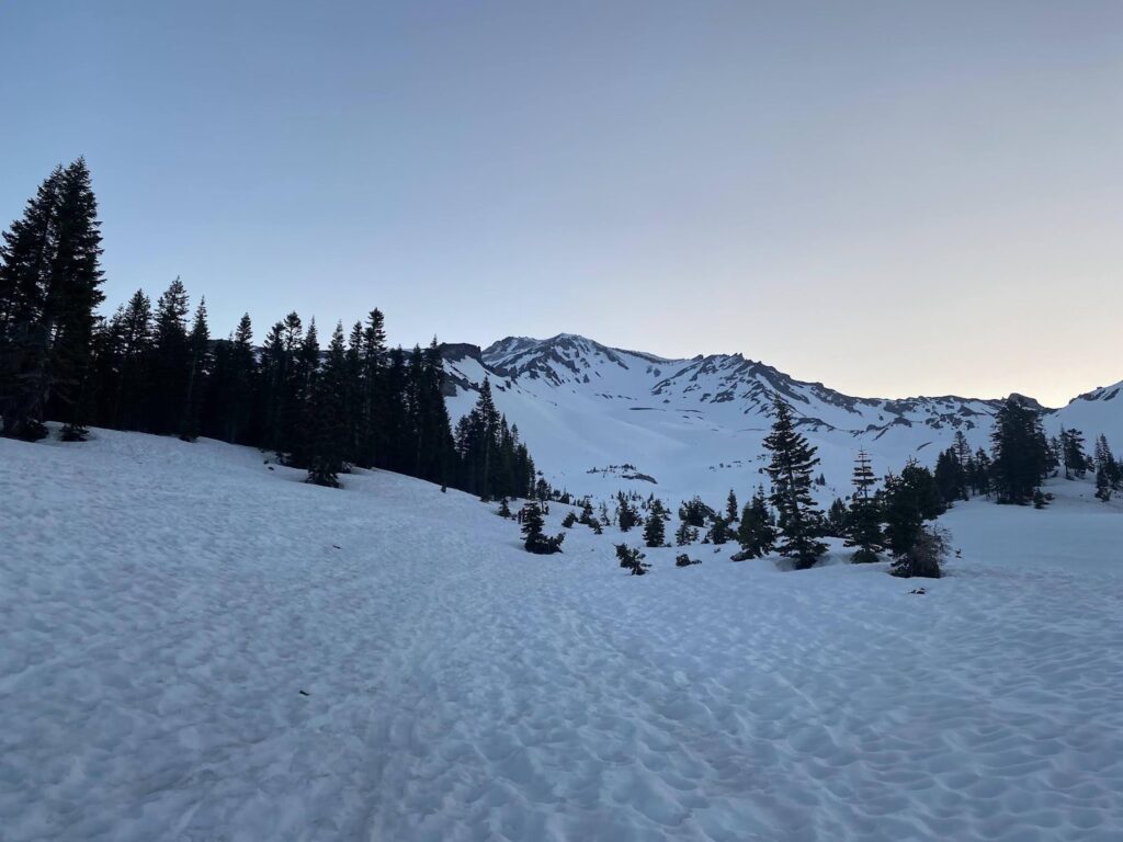
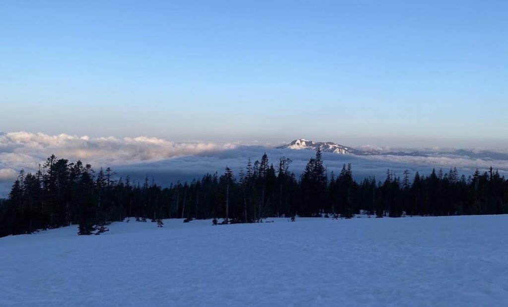
Spring was in full swing when Nathan and I arrived. Recent storms brought new snow to upper elevations and shrouded visibility with cloud cover in the week leading up to our attempt, but we had ourselves a window of mostly clear weather. It was late May of a historic year of snowfall, so the white stuff lingered at lower elevations on the mountain, allowing us the distinct privilege of stepping from a dry parking lot directly onto snow to start ski touring at 6,900 ft.
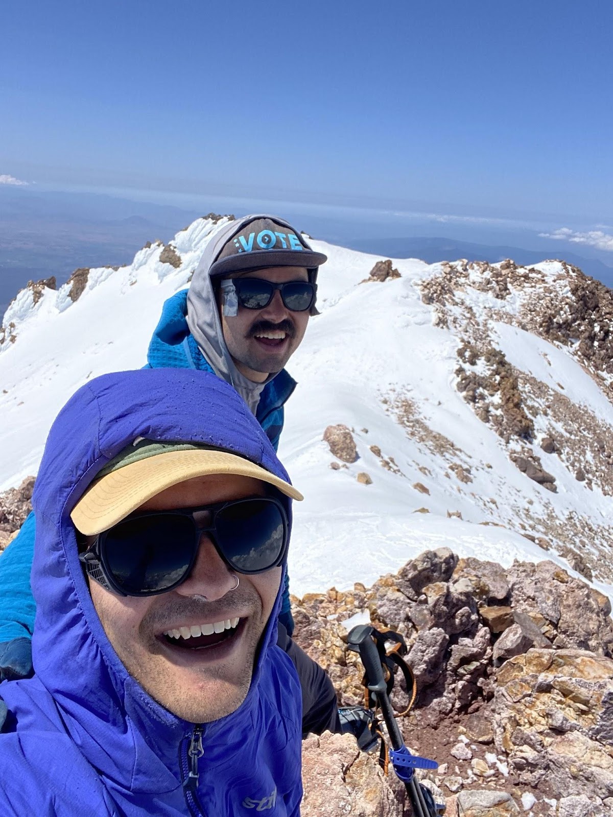
Once parked at Bunny Flat, we filled out our permits and paid our summit fees before retiring, giddily, to the back of our vehicles to get some restless shut-eye before an early morning departure. Our intended climbing route was Avalanche Gulch; our intended ski objective was the West Face. By 4:45 AM, Nathan and I were dressed in our ski touring gear and putting skins on our skis as we sipped hot coffee. Thirty minutes later, we scrambled up the side of the head-high snowbank just around the corner from the trailhead outhouse and stepped into our toe pieces to begin our climb.
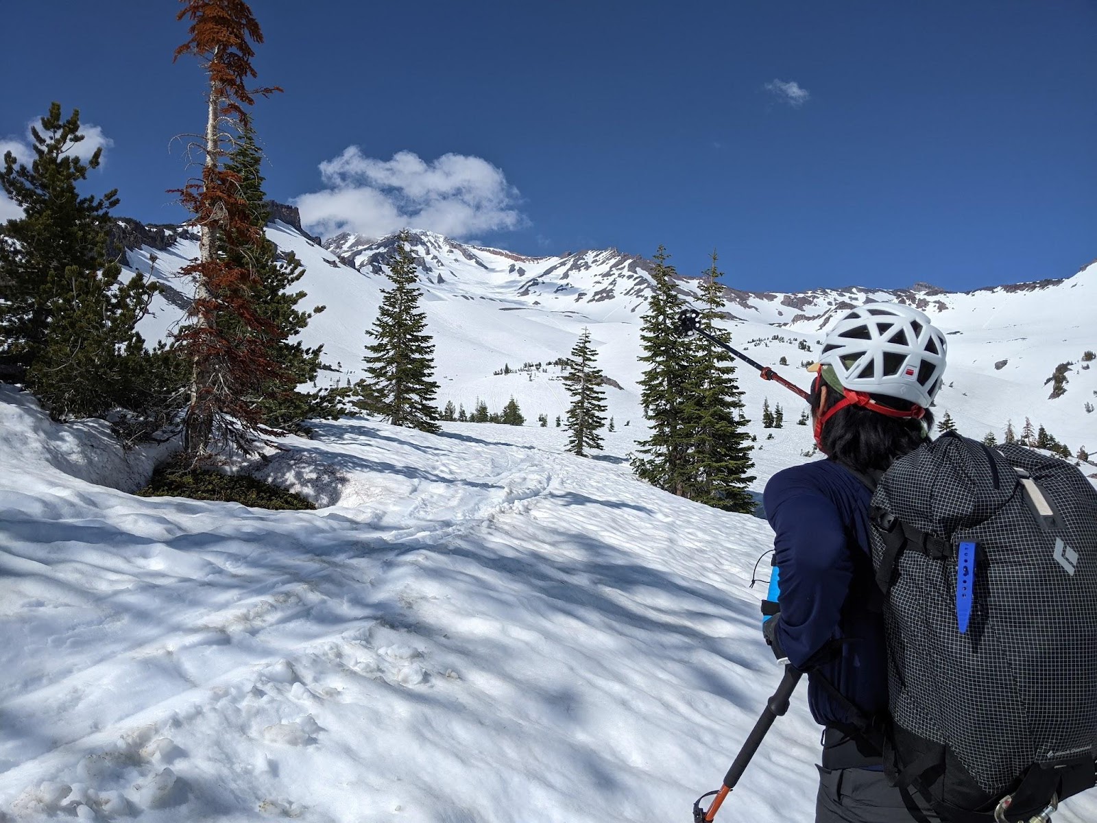
In the calm of predawn, we skinned along a strip of snow through trees, parallel to a shallow ravine, alternating between lightly side-hilling on one side of the creek and the other. We encountered a man from New Mexico who began his quest around the same time. He spoke of the mystical pull of this mountain which beckoned him to be there exactly then.
Before long, the forest of firs and pines thinned out. The immense majority of the mountain appeared before us above the treeline as we entered Avalanche Gulch proper, the largest glacially carved valley on the mountain, though no glacier resides there now. Shasta lies east of the Klamath Range which captures most of the possible precipitation from moisture blowing in from the Pacific Ocean. This precipitation deficit gives Shasta its sparse, stunted forests compared to other Cascade volcanoes like Hood, also to its north. It also means that the geology of Shasta itself is subjected to fewer of the erosional forces of falling water, snow, and ice, allowing the mountain to retain more of its “original” appearance than the others of its order.
To our right stood the oldest structure of modern Mt. Shasta, the Sergeant’s Ridge cone, which grew over a period of eruptions and material upwellings over 100,000 years ago. Our route was straight up the gut of Avalanche Gulch, up to a saddle at above 12,000 ft; and then up and over Misery Hill to the summit. The route to Misery Hill lies entirely on Shasta’s second volcanic cone, the Misery Hill cone, which, at 25,000 years old, is much younger than the Sergeant’s Ridge cone. It takes its name from the aptly named false summit that awaited our high elevation slogging.
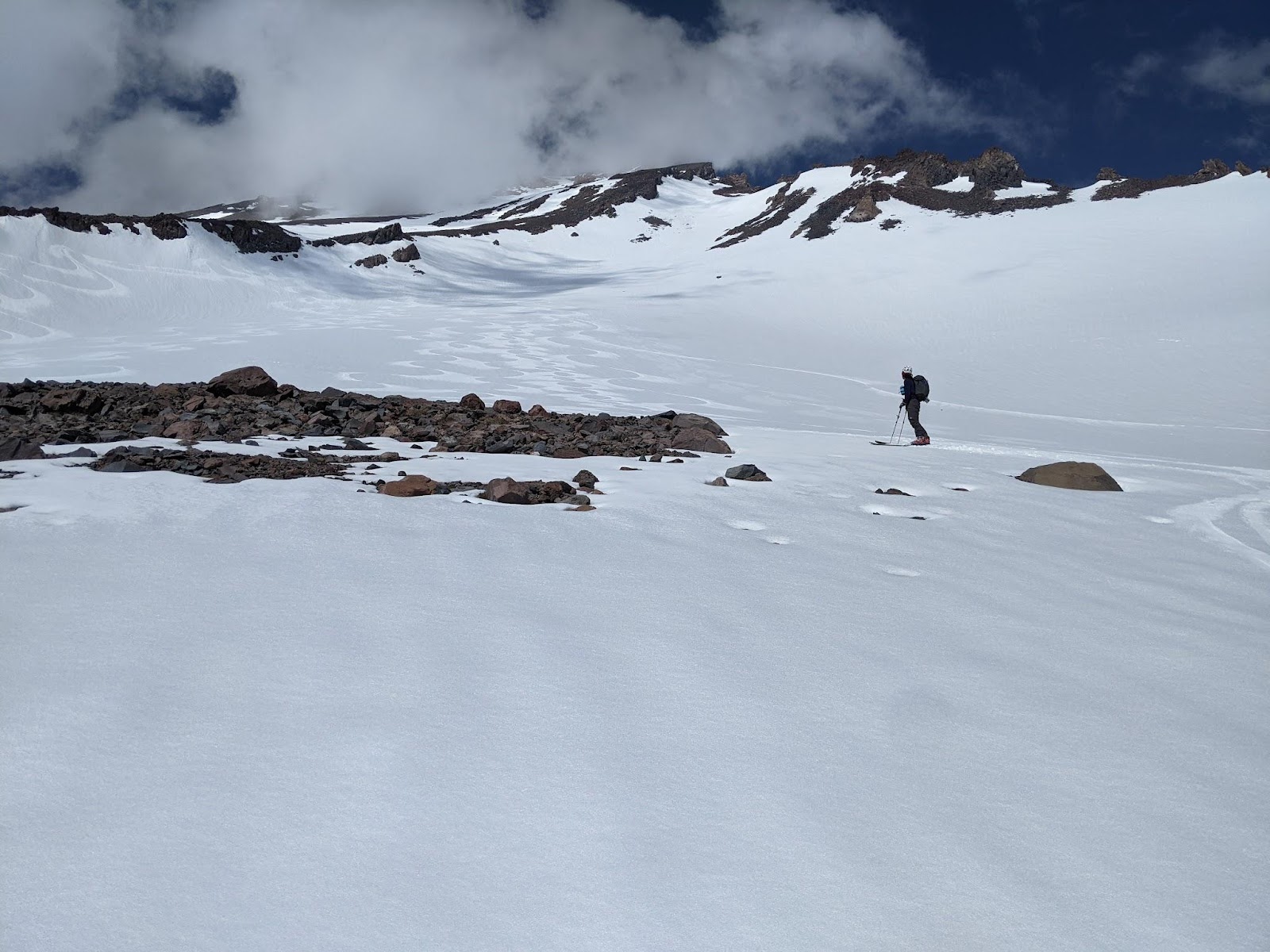
As we climbed higher, the slope got steeper. The snow surface above treeline was frozen slick and hard, and sun-cupped. Sun cups are a result of portions of the snow surface melting at different rates. This is likely caused by dirt in depressions melting faster and deepening the depression, or due to mild winds cooling the ridges between melting depressions. Sun cups form in grids across the snow surface, creating a widespread, non-uniform surface. Needless to say, when frozen like this, they are an absolute pain to gain enough purchase on to skin up. Nathan and I paused to watch the sunrise colors dance across the southern horizon, glimpsing the shadow of Shasta itself cast across the clouded lowlands. We decided to put on ski crampons to make the going easier over the icy and deeply dimpled snow. At the crest of a knoll, a break in the clouds allowed me the opportunity to snap a photo of another volcano, Lassen, visible in the distance to the east. I removed my glove, accidentally dropped it, and watched as it skittered, just out of reach. It gained speed, sliding down through the basin Nathan and I just climbed, across another flatter section of slope, and over another knoll and continued tobogganing down Avalanche Gulch, never to be seen again. Thankfully, we had an extra pair.
The Challenges of Avalanche Gulch
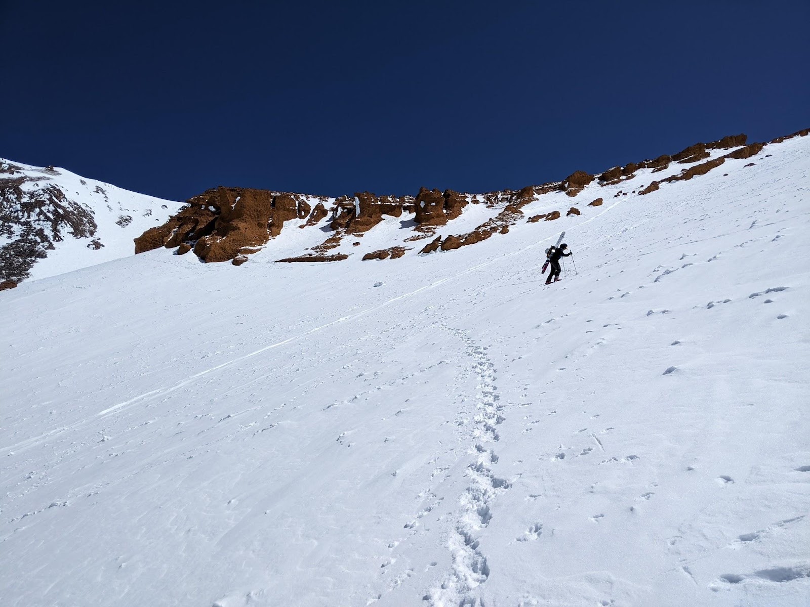
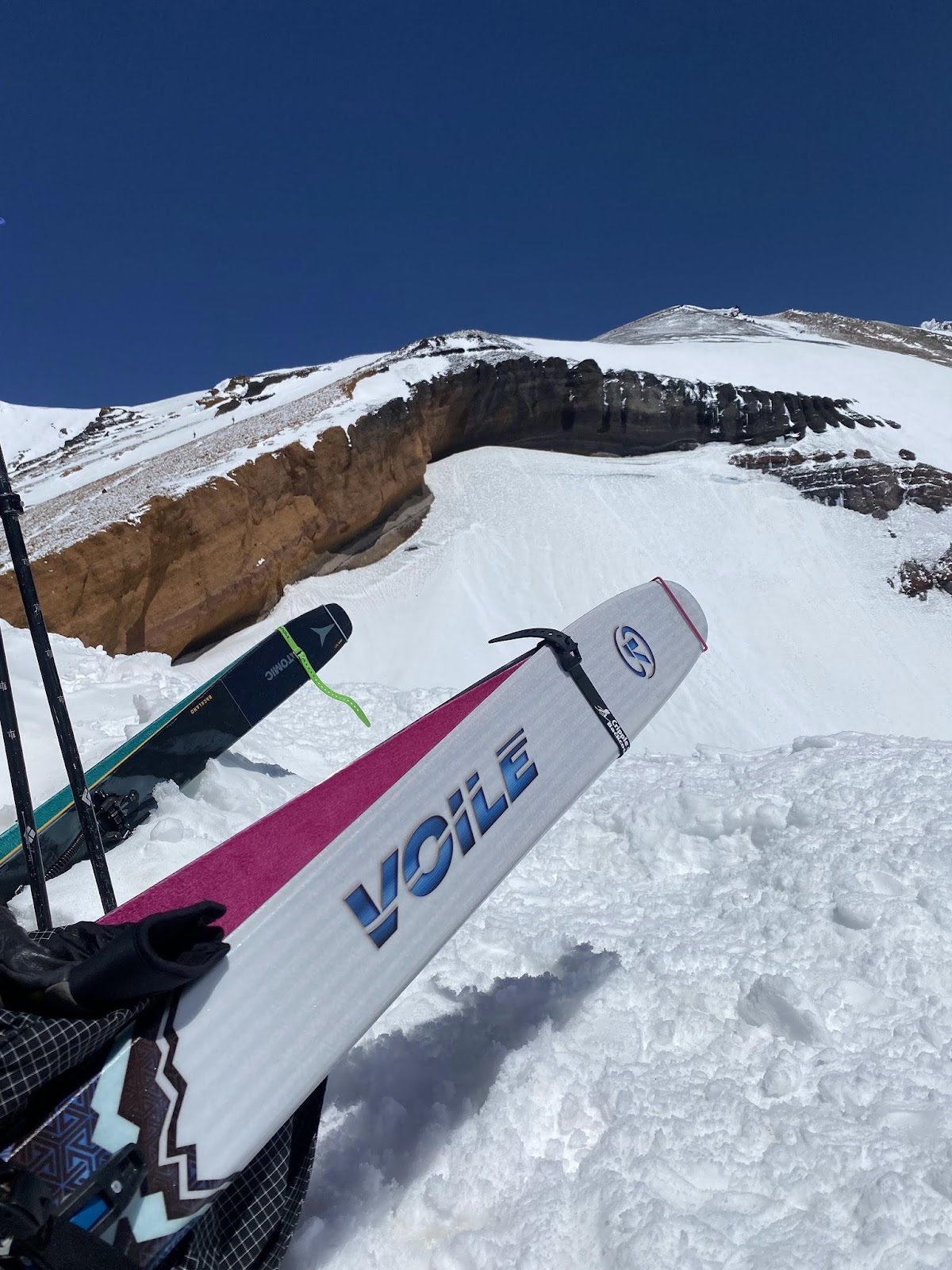
At around 11,500 feet, about four and a half hours into our climb, we Voile-strapped our skis to our packs A-frame style, put crampons on our ski boots, and began booting up the still shaded and firm slope up to the head of Avalanche Gulch in a series of switchbacks. My HyperVectors felt light, but sturdy on my backpack. We made our transition next to a frozen pile of day-old avalanche debris, a reminder of why we had better keep moving while the sun was still shielded from the aspect we were climbing. Another hazard existed here, though: Rockfall. Above us was a stout, orange headwall, about 200 feet thick. The slope was littered with fragments of the porous lava rock pumice that had evidently come loose from the looming feature, falling during warming events and refreezing into the matrix of the surface snow overnight. The orange band of rock is the Red Banks tephra, a rapidly cooled lava rock from one of Shasta’s most explosive periods, starting about 9,700 years ago.
At 12,830 ft. we rested next to the thickness of the Red Banks formation, admiring its orange tint and looking ahead to the partly snowy, partly rocky route above. Clouds swirled in almost all directions but never occluded our path or otherwise threatened us. We felt good about our timing and pace to this point. The sun was beginning to sneak across the sky where it would soon start shining obliquely on the West Face, softening the snow to a perfect consistency for skiing for future us.
Misery Hill and the Summit
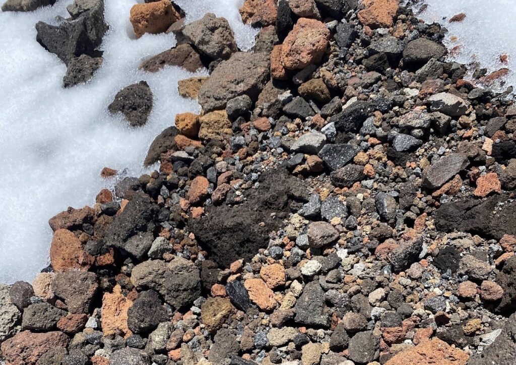
Misery Hill was before us. We slowly ambled towards it along the ridge, both of us panting, with mild headaches, stomach unease, and general slowness from the apparent effect of high elevation. The false summit of Misery Hill precluded our view of the true summit. We walked through a mix of thin snow and loose rock. The path was littered with variably colored lava rocks: a collection of lighter colored andesites from the Misery Hill cone or above, orange rock from the Red Banks, and darker basalts from even more recent low viscosity lava flows.
Nathan and I found ourselves above the entrance to our intended ski descent. After much deliberation, we decided to stash our skis and the majority of our loads there on a snowy patch to the side of the rocky route, anchoring the straps of our packs with ice axes and made the dash up and over Misery Hill to the summit with just some water, snacks, and our ski poles.
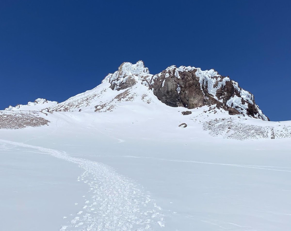
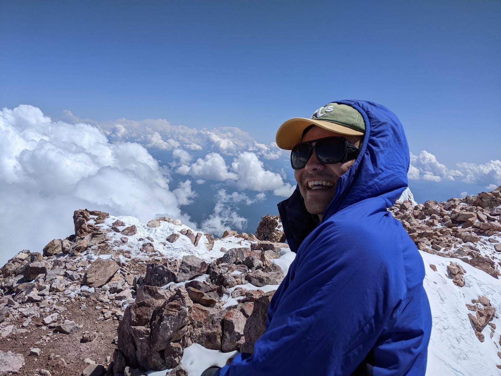
At the crest of Misery Hill, we glimpsed Shasta’s true summit and the crater of the volcano. The roughly 600 ft. basin is the plugged opening of the Hotlum cone, the youngest of Shasta’s four, forming within the last 9,700 years. Eruptions of volcanic gas and material and mudflows have been recorded as recently as 240 years ago. This summit cone is named for the Hotlum glacier, Shasta’s largest by volume, which flanks the northeast side of the mountain, the side we saw nothing of until we stood on the summit. The true summit of Shasta is composed of light-colored andesite, fragments of which we likely saw scattered on the way up Misery Hill, resulting from a dome of silica-rich material that rose up in the cone. The young summit looked like a volcanic rock fortress, a specter surveilling the crater below, covered in rime but otherwise untouched by time. According to the map, it was only 600 ft. or so above where we stood, but it appeared a thousand times taller before us.

The clouds were thick between us and Lassen, to the east, but from the summit of Shasta we could faintly make out the form of what I believe is one of the Three Sisters, another volcano group all the way north in central Oregon. The climb to the summit took us nine and a half hours total. Nathan and I truly felt awful at the summit on account of the both of us traveling from sea level to 14,179 ft. of elevation within 18 hours. We quickly retreated from the summit and ambled down back towards our skis and packs with anticipation both for relief from our altitude sickness symptoms and of the 6,000 ft. of spring skiing still ahead of us.
From the base of Misery Hill we skirted the Whitney glacier, which sits on the saddle between the Hotlum cone summit and a subpeak called Shastina. The Whitney glacier is the thickest glacier on Shasta, though its total volume is tiny compared to the Hotlum glacier. All of Shasta’s glaciers appear to be younger than 2,000 years old, and have yet to leave any indelible mark of their own on the mountain in its relative youth. The path and bounds of the glaciers, at this age, seem to be more defined by the shape of the mountain and its lava flow ridges than the other way around.
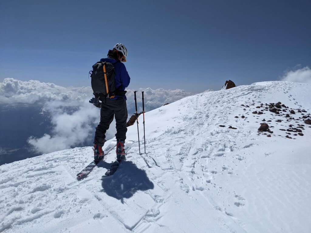
Skiing the West Face
At the entrance to the West Face, Nathan and I took care of our fueling needs, drinking our remaining water in excess, snacking more ravenously than any prior break. We were energized for the original main goal of the day, a ton of awesome skiing together. After we transitioned to ski downhill and discussed our plan for safe descent, I looked back up towards the summit. From our location, Misery Hill was out of our line of sight, and the Hotlum summit stared back. I recognized the hold that fortress now had on my mind and knew that the mountain itself was the standout of this experience, even before we started skiing.
Nathan and I leap-frogged the descent of West Face: one of us skiing a few hundred yards or so down the slope before pulling off from the fall line into a secure spot before the other skied down and past, stopping a similar distance below again and so on. Here, the HyperVectors really shined as I arced out long, knee-dropping turns upon this titanic volcano’s slope. We hooted and hollered, skiing what felt like endless corn in prime conditions along the edge of another outcropping of Red Banks pumice. Fast-moving clouds transited the sky just above our heads. Towering to skiers’ right was that subpeak Shastina, the product of the third volcanic cone in Shasta’s recent history. Eruptions and upwellings off the main structure of Shasta in the last 12-10,000 years built Shastina on the western flank of the Misery Hill cone. Lava flows from Shastina extend 20-some miles from the cone itself. If Shastina stood alone it would still be the third tallest Cascade stratovolcano, at 12,335 ft; behind only Tahoma and Shasta itself.
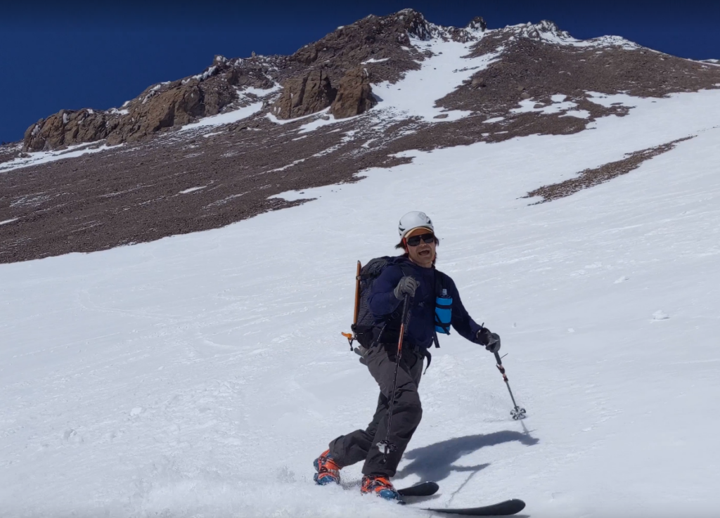
On either side of the wide strip of snow were low ridges of fragmented Red Banks pumice and dark, broken rock from basaltic, lower viscosity lava flows. We leap-frogged five or six times before taking turns airing over rock through a choke into the otherwise continuous snow surface covering the wide gulley directly beneath Casaval Ridge. We skied side by side through the remaining rolling slopes before carrying speed across the flat, open drainage at about 9,300 ft. With a moderate dose of “shwacking” through manzanita thickets and taking skis off and putting them back on once or twice to crawl over loose rock, we traversed back into the broad opening of Avalanche Gulch at about treeline, or a little less than 8,000 ft. We were more or less exactly where we found ourselves at sunrise 11 hours earlier. We gazed back up the Misery Hill cone to Misery Hill itself, in awe of the effort now behind us and the summit block that we knew lay hidden behind what we could see of the Hotlum cone.
Nathan and I skied back through the pine and fir forest along our original skintrack from the morning. The snow was soft and soupy from the sun and was no longer the slick, frozen medium it was in the dark. Our bodies jolted with abrupt deceleration as we passed from cooler tree-shaded snow back into sun-beaten snow along the final gradual descent back to the parking lot.
Reflecting on a Volcanic Adventure
Almost 12 hours exactly it took us to amble up those 7,500 ft. and ski down in those most excellent conditions. Once back at our cars, we hugged deeply, shared long-winded gratitudes for each other and the mountain, changed into dry cotton T-shirts, packed up our gear, and headed into town for a big meal at a grill with the volcano Shasta itself as the scenic view to boot. Nathan got back in his car to drive home to San Francisco. Though I was heading to the same place to be with the same people, I decided to postpone my arrival in the city just one more night. The mountain had some kind of hold on me, and I wished to be near it and its awesome volcanic presence for one more night.
About The Author
Garrett Schlag
Location: Traditional Land of the Coast Salish, Duwamish people (Seattle, WA)
Top Gear Picks: V6 183cm / HyperVector 177cm
Instagram: @garryvox_s
Garry's skiing career contains competitive moguls and big mountain skiing, filming park edits, alpine touring, ski joring, outdoor education expedition leading, ski patrolling, telemark skiing, and shop tech. They are eager to interact with volcanoes in, and get to know the Pacific Northwest after a lifetime of skiing in the American southwest.
In addition to skiing, Garry loves science education, the Grateful Dead extended universe, riding bikes, playing guitar, whitewater, and their cat Gnome.
Share this Post